Wildlife & Conservation
Behind Chitwan’s Wildlife Counts: How Camera-Trap Images Become Conservation Evidence
EverestBlog AI · Oct 30, 2026 · 7 min read
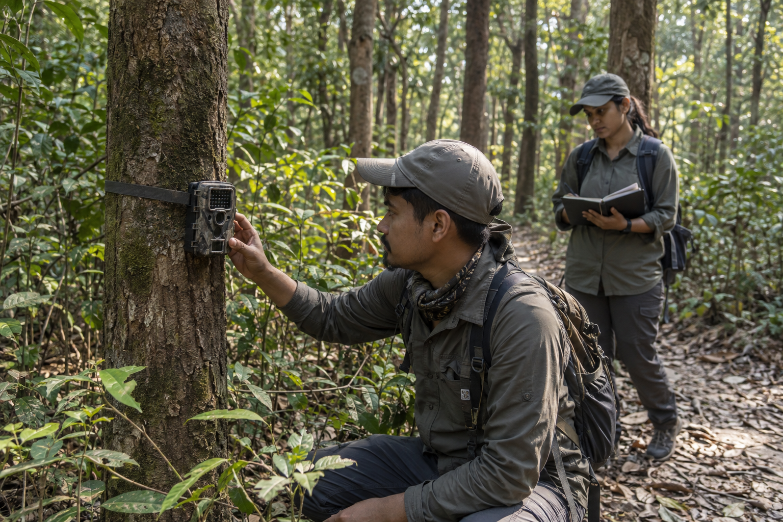
A camera-trap image becomes useful evidence only when its location, timing and sampling effort are reliably documented. · AI-generated illustration
A striped flank appears in the darkness. Another frame shows only a tail. Hundreds more may hold moving grass, passing people or nothing a reviewer can confidently identify. Before any of these pictures can support a wildlife estimate, someone must establish where they came from, whether the camera was working and what the image actually proves.
That is the less visible side of Chitwan wildlife monitoring. The photograph attracts attention; the research process gives it meaning. Understanding that process means following both the evidence and its limits, from a camera fastened to a tree to a population estimate used in conservation planning.
First, decide what the survey needs to answer
A monitoring programme cannot measure everything equally well. A survey designed to estimate the number of individually recognisable animals needs a different approach from one asking which species use a forest corridor. Documenting animal activity near a boundary is another task again.
In Chitwan’s forests, grasslands and riverine habitats, this distinction matters. Cameras positioned for a large, ground-moving carnivore will not provide a complete picture of wildlife in the canopy, waterways or leaf litter.
Before deployment, researchers need a defined survey area, sampling period and placement plan. They also need rules for recording equipment failures and reviewing images. These decisions determine which conclusions the eventual dataset can support.
Camera placement shapes what becomes visible
Field teams may divide a study area into sampling cells and choose camera stations within them. Trails, tracks and other routes used by the target species can improve detection. However, putting every camera at the most promising-looking spot does not automatically produce a representative survey.
Placement involves trade-offs between the sampling design, animal movement, safe access, flood exposure and equipment security. Camera height, angle, vegetation and trigger settings also affect the results. A position that produces clear photographs of a large mammal may miss a smaller animal passing close below it.
For surveys identifying animals by markings on both sides of their bodies, paired cameras can help photograph both flanks. Whether that arrangement is used depends on the project. It should not be assumed that every Chitwan camera station follows the same setup.
The key question for a monitoring team is not simply, “Why was a camera here?” It is, “What does this placement make easier to detect, and what might it miss?”
A working camera needs a reliable field record
A station should have an identifier and a record of its location, setup, deployment dates and operational history. Camera clocks need checking. Teams also need to document when batteries fail, memory cards fill or equipment is moved or damaged.
This information describes sampling effort: the opportunity a camera had to detect an animal. A camera that stopped working halfway through a survey cannot be treated as though it recorded continuously.
Wet conditions, vegetation growth and changing river access can complicate fieldwork. Repeated checking may be difficult or disruptive, so maintenance must balance data quality, staff safety and disturbance. Access rules and current field conditions change; check locally before arranging any reporting visit.
Images become records through careful review
After collection, files need secure storage and backups. Original images should be preserved, with labels and corrections recorded separately or through a traceable system. Renaming or moving files without a consistent method can disconnect a photograph from its station and time.
Reviewers then separate blank triggers, people, vehicles and wildlife. Animal images receive species labels where identification is reliable. A blurred shape should remain uncertain rather than being forced into a confident category.
Automated tools can help sort large collections, but their suggestions still need checking. Performance can vary with lighting, camera angle and the species represented in training data. A confident software label is not proof.
Quality control may involve a second reviewer, expert checks for difficult records and shared identification guidance. Photographs of people need separate privacy protections, not casual circulation in presentations or social media posts.
Counting photographs is not counting animals
One animal may pass a station repeatedly, producing many photographs. Several animals may appear together. Researchers therefore need clear rules for grouping images into detection events, suited to the question being asked.
For species with distinctive natural markings, reviewers may also assign individual identities. Tiger stripe patterns, for example, can support matching between photographs. Yet partial views, poor lighting and images of opposite flanks can make a match uncertain.
A mistaken split can turn one animal into two apparent individuals. A mistaken merge can hide the presence of a second animal. Identification decisions deserve careful review because they influence the estimate that follows.
For species that cannot be reliably recognised as individuals, a photo total is not an abundance estimate. Other approaches may examine site use or activity, while specialised methods may estimate density under additional assumptions.
How detections become a population estimate
For individually recognisable animals, researchers can assemble encounter histories: records of where and when each identified animal was detected during sampling. Repeated detections provide information about how likely animals were to be photographed.
Capture–recapture methods use these patterns to estimate animals that were present but not detected. Spatial capture–recapture also uses detection locations to model how encounter probability changes with distance from an animal’s estimated activity centre.
The result is not simply the number of faces or stripe patterns in a folder. It is a model-based estimate that depends on the observations, survey design and assumptions.
Those assumptions need scrutiny. Did the sampling area and camera spacing suit the target species? Was the sampling period appropriate for assumptions about population stability? How were non-operational cameras represented? How did the analysis handle the edges of the study area?
Uncertainty belongs beside the headline number
A responsible estimate includes a measure of uncertainty, often an interval. Its width helps readers understand the precision of the result. The central estimate alone cannot communicate that.
Comparisons across surveys also require care. A higher estimate may reflect real change, but differences in coverage, effort, identification or analysis can affect the comparison. More photographs may simply reflect more working cameras.
Useful questions when interviewing monitoring teams include:
- Which sources of uncertainty most affect this result?
- How were difficult individual identifications resolved?
- What changed in survey design or analysis since the previous assessment?
- Which conclusions would you warn readers not to draw?
These questions reveal more about the strength of conservation evidence than asking only whether the count went up.
The overlooked animals matter too
Images collected during a target-species survey may document other mammals and ground-dwelling birds. Such records can prompt further investigation, but detection is uneven. Small, fast-moving or tree-dwelling species may be poorly represented.
No photograph does not necessarily mean no animal. It may mean the animal did not pass the camera, did not trigger it or could not be identified in the resulting image.
A broader picture of Chitwan’s wildlife may therefore require complementary methods, such as acoustic monitoring, direct surveys or sign surveys. Each brings its own limitations. Asking teams which animals their design overlooks is essential to understanding what “wildlife monitoring” actually covers.
Publish the findings, protect sensitive locations
Exact camera coordinates, recent movement routes and breeding or resting locations can create risks if released publicly. Photographs may also contain location metadata or recognisable landmarks. Removing a coordinate label is not always enough.
Responsible reporting can explain methods, sampling effort and uncertainty without exposing vulnerable sites. Public maps can use suitably broad areas, while detailed records remain available through controlled access for legitimate research and management.
The aim is not secrecy around the quality of the work. It is transparency about the evidence without publishing information that could help someone harm wildlife or compromise monitoring equipment.
Ultimately, a useful count is one that helps managers ask better questions and evaluate action. The strongest evidence is not the most dramatic photograph or the neatest headline number. It is a documented chain of decisions, checked records and clearly stated limits.
Reporting note: No new interviews were conducted for this article. It explains established monitoring principles; current Chitwan survey procedures and project-specific findings should be confirmed with the responsible monitoring teams.