
Wildlife & Conservation
When Chitwan Floods: Where Can Wildlife Reach Higher Ground?
EverestBlog AI · Oct 31, 2026 · 16 min read
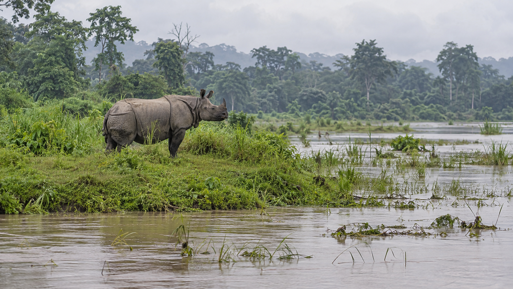
Flooded grassland and raised forest illustrate a critical question for Chitwan’s wildlife: is dry ground within reach? The scene alone cannot establish an escape route. · AI-generated illustration
When monsoon water rises in Chitwan, can wildlife reach dry ground? A patch of higher land may be visible across a flooded grassland, yet visibility does not make it reachable. For an animal leaving a riverbank, woodland or feeding area, safety depends on the journey as well as the destination. How deep is the water between them? Is the current strong? Is there somewhere to pause? And does the dry ground offer enough shelter for an animal to stay until the water falls?
These questions sit at the heart of Chitwan wildlife floods: not simply which places go underwater, but how animals can move as familiar habitat changes. Chitwan National Park and its surrounding landscape include river floodplains, grasslands, riverine forests, sal forests and hills. The Rapti, Narayani and Reu help shape this setting. During the monsoon, rising rivers and heavy rain can change the relationship between these habitats, turning a nearby feeding area into flooded ground or making a familiar crossing more difficult.
Flooding is part of the natural life of a floodplain. It moves sediment, reshapes river edges and helps maintain a changing mixture of habitats. But that does not mean every flood is easy for wildlife to survive. The speed of the rise, the force of moving water and the length of inundation all matter. So does an animal’s position when conditions begin to change. A creature already near a wooded slope faces a different situation from one feeding on low ground with water rising around it.
Flood-time habitat connectivity means the usable links between habitat covered by water and a place of refuge. In plain English, it asks whether wildlife has a workable way from wet ground to safer ground. That link might involve a gradual rise in the land, a stretch of forest or a sequence of resting places. It is not necessarily a narrow, fixed corridor. As water spreads and recedes, the usable connection may shift, shrink or become available again.
The word usable is important. A line drawn between two green patches on a map cannot show whether an animal can travel between them during a flood. Even land that remains above water may offer little cover or bring wildlife close to people. A refuge also needs to be considered over time: a patch that is dry early in a flood may not remain dry if river levels continue rising. Reaching it is only one part of finding safety.
Nor do all animals experience the same landscape. Chitwan supports greater one-horned rhinos, tigers, deer and many smaller animals, each with different movement abilities and needs. Swimming ability alone does not settle the question of access. Strong currents, exhaustion and the need to move with young can change what is possible. Smaller ground-dwelling animals may depend on nearby raised patches or vegetation rather than a distant hillside. There is no single escape route that can be assumed to work for every species.
This investigation therefore begins with questions rather than a claim that particular routes are blocked. Where does potentially useful higher ground lie in relation to flood-prone habitat? What lies between the two? How might farms, settlements, roads and other land uses affect a journey under flood conditions? Answering these questions requires attention to terrain, changing water levels and animal movement, not just the boundaries of protected land.
For readers, this distinction changes how a flood story is understood. Seeing wildlife on dry ground does not reveal how difficult its journey was; seeing flooded habitat does not prove that escape was impossible. Local observations and conditions during each event matter. The central question is whether Chitwan’s living landscape gives animals a usable connection to safety when water redraws the map—and whether that safety lasts long enough for them to return.
How Floodwater Changes the Habitat Map
For wildlife in Chitwan, a flood changes more than the riverbank. It changes which feeding areas, resting places and escape routes remain usable. Flooding associated with the Rapti, Narayani and Reu can turn connected grassland and forest into separate patches, with water between them. Yet “flooded” is not a single habitat condition. Shallow, slow water over grassland presents a different challenge from a fast channel cutting across an animal’s route to dry ground.
Three rivers, different local effects
The Narayani borders Chitwan National Park to the west, while the Rapti runs along much of its northern edge before meeting the Narayani. The Reu drains the Madi Valley to the south. Their floodplains connect with smaller streams, old channels and low depressions. Water can therefore reach wildlife habitat through several pathways, not simply by spilling evenly over a riverbank. High water near a confluence can also slow drainage from adjoining areas.
These differences matter when reading reports of Chitwan wildlife floods. A flooded stretch beside the Rapti does not establish the condition of forest beside the Reu. Nor does a high Narayani reading prove that every nearby grassland is submerged. Rainfall location, river levels, bank shape and local elevation influence where water goes. Conditions must be assessed by river reach and observation time, rather than described as one park-wide event.
Seasonal inundation is not the same as an extreme flood
Routine monsoon inundation is part of the floodplain’s ecology. It can deposit sediment, replenish wetlands and reshape the balance between open grassland and riverine vegetation. Wildlife may temporarily leave low feeding areas and return as water recedes. This does not make seasonal flooding harmless: a newborn animal, a ground nest or a small mammal in a burrow can be vulnerable even when the wider floodplain remains connected.
More severe events can remove that flexibility. Deeper water may cover familiar crossings; faster currents can make a short passage dangerous; prolonged inundation can keep food and resting sites unavailable. Bank erosion and shifting channels may also change the route after the water falls. Severity therefore depends on more than how far the flood spreads. A smaller area of deep, fast water may block movement more effectively than broad, shallow inundation.
- Depth: Ask whether water merely covers vegetation or submerges the ground animals would otherwise stand on. A satellite flood outline alone cannot answer this.
- Speed: Moving water creates a different risk from ponded water. Narrow crossings, active channels and breached banks need particular attention.
- Duration: A brief interruption and several days without accessible forage have different consequences, even with similar mapped flood boundaries.
- Isolation: A dry patch may remain visible while every approach is underwater. Dry land is not necessarily reachable refuge.
Read dated maps alongside river records
Nepal’s August 2017 floods provide a dated event to investigate, not a template for every Chitwan monsoon. Satellite flood maps from that emergency should be checked for their coverage, acquisition date and limitations before being used to describe a particular park sector. An image records one observation window: it may miss the local peak, and water beneath tree cover can be difficult to detect.
Pair each mapped observation with Department of Hydrology and Meteorology records for the relevant catchment. The Narayani gauge at Devghat provides local hydrological context, but its reading is not a measurement of water depth inside a distant grassland. Rapti and Reu conditions require their own available river observations, rainfall records and field reports; check locally for station coverage and data access.
The strongest habitat assessment compares dated flood outlines with terrain and observations from park staff. It asks which patches stayed dry, when connecting ground flooded, and when access returned. Those findings describe that place and event—not the whole park or every future flood.
Which Higher Ground Can Wildlife Actually Use?
For Chitwan wildlife floods, the useful question is not simply where the land rises. It is whether an animal can reach that rise before water cuts off the approach, and whether it can remain there safely. A forest patch may stand above nearby grassland yet still become an island. Higher slopes may offer dry ground but little suitable food. Candidate refuges therefore need both a terrain check and field verification.
Look for a network of dry places
Inside Chitwan National Park, candidates include raised forest patches, locally elevated ground within the floodplain, and forested rises connected to less flood-prone terrain. These are possibilities to investigate, not a confirmed refuge map. Tree cover alone does not prove elevation or safety: a wooded patch can flood, and erosion can remove an approach that remained usable during an earlier monsoon.
Higher terrain toward the Churia foothills is another candidate, particularly where continuous habitat connects lowland feeding areas with gentler lower slopes. But “toward the hills” is not a complete escape plan. Steep banks, gullies, swollen streams and unstable slopes may interrupt the journey. The most useful refuge could be a broad, accessible rise near the foothills rather than a much higher, harder-to-reach ridge.
Beyond the park, elevated buffer-zone forests and adjoining community forests deserve assessment where their location and management allow wildlife access. Some may provide temporary shelter or a link to larger dry areas. Others may be separated from the park by settlements, roads, fences or cultivated land. Their value depends on the whole connection, not simply their presence on a map.
Different animals need different approaches
Rhinos can swim, but that does not make every flooded crossing safe. Strong currents, debris and steep exit banks can turn a short route into a dangerous one. For a large, heavy animal, firm approaches and manageable slopes matter. Dry ground also needs accessible forage nearby; a refuge that offers shelter but forces repeated journeys through floodwater to feed has clear limits.
Deer should not be treated as one uniform group. Chitwan’s deer species differ in habitat use, and individuals may respond differently according to age, condition and whether they are accompanying young. An open rise might offer feeding space but little concealment. A wooded rise might provide cover while offering less suitable grazing. Neither should automatically be labelled adequate for every deer species.
Smaller ground-dwelling mammals, reptiles and other animals face a different scale of obstacles. A flooded ditch or fast-flowing channel that a larger animal can cross may sever their route. Nearby hummocks, raised banks and dry vegetation cover can matter more than distant hills. Burrows may become traps when water rises, while exposed resting places can increase vulnerability to predators. Refuge planning must therefore include small, closely spaced dry patches, not only large forest blocks.
Test the route, then test the refuge
Assess each candidate as a practical journey and a temporary living space:
- Approach: Is there a continuous route with usable entry and exit points as water rises?
- Cover: Can animals rest without constant disturbance, exposure or crowding near people?
- Food: Is suitable forage available on dry ground or safely within reach?
- Capacity: How much usable space remains at peak water, and for how long? Area alone cannot show how many animals it can support.
Observed movement and plausible access must remain separate. A dated ranger sighting, camera record or clearly documented track observation can establish that an animal used a place during a particular flood. It does not prove that the route stays safe in larger floods, or that other species use it. Elevation maps and habitat connections can identify plausible routes, but these need ground checks and repeated monitoring. Check locally with park staff and community forest managers for recent flood observations; record uncertainty rather than turning a promising line on a map into an established wildlife escape route.
Does Land Use Leave a Way Through?
Higher ground is useful only if animals can reach it. For Chitwan wildlife floods, the land between a riverbank and a wooded rise deserves as much attention as the refuge itself. A forest patch may look connected on a map yet be separated from the floodplain by fencing or densely occupied land. Conversely, a mixed landscape of community forest, scrub and fields may retain passage, although its usefulness varies by species and flood conditions.
Trace a link, then test the evidence
A careful assessment should start with recent land-cover maps, terrain information and flood footprints from identifiable flood events. Together, these can show where inundated habitat approaches land that stayed above water, and what lies between them. Along Chitwan’s southern side, the Churia foothills offer an obvious area to examine, but proximity alone does not establish an accessible escape route. Elsewhere, smaller rises may matter, provided they remain reachable and offer enough space.
Each proposed connection needs a clear evidence label. A candidate link is a plausible passage suggested by terrain and land cover. A documented flood-time link requires evidence of animals using it during flooding, with the location and circumstances recorded. Neither a strip of green on a satellite image nor an animal sighting in the dry season proves flood-time use. Without site-specific records, naming a route as established would overstate the evidence.
Flood footprints also need dates and limitations. An image may capture water after its peak, miss inundation beneath tree cover or conceal details under cloud. Land-cover categories can hide equally important differences: “forest” might include a dense stand or a narrow, disturbed strip. Comparing several observations is more useful than treating one map as a complete account of access.
Ask what has changed on the ground
Interviews should bring park staff, buffer-zone community forest groups and nearby residents into the same investigation. Ask each group to identify locations on a shared map rather than relying on broad descriptions. Useful questions include where animals were seen during a particular flood, which direction they travelled, whether they turned back, and what had changed since earlier events. Record whether an account is a direct observation or something heard from another person.
- Forest clearance: Check whether lost tree or scrub cover has broken a continuous strip, reduced shelter or left an exposed gap. Clearance marks a habitat change; it does not automatically prove that movement has stopped.
- Settlement expansion: Compare building footprints over time and inspect the remaining spaces between them. A narrowing gap is a mapped concern, while repeated observations of animals retreating would provide stronger evidence of a movement barrier.
- Cultivation: Identify crop types, seasonal cover and field boundaries. Fields may remain physically crossable, but crop guarding, disturbance and changing vegetation can make passage unreliable.
- Fencing and embankments: Record continuity, height, materials, openings and slopes. Their effects depend on the animal and flood conditions; an embankment may provide a raised surface in one place while obstructing access in another.
Look for land uses that keep options open
Community-managed forest, regenerating scrub, connected woodland edges and unfenced open ground are worth examining as possible passage-retaining uses. Their value depends on continuity, disturbance and whether they connect flooded habitat to usable refuge. A forest patch isolated by development should not be counted as a functioning link simply because it remains wooded.
The strongest local assessment would pair every mapped pinch point with a field check and an evidence note. Separate visible obstacles, such as a continuous fence, from documented movement barriers, where observations show blocked or redirected animals. Also mark uncertainty: passage may remain unobserved rather than absent. This creates a practical basis for discussing retained vegetation strips, fence openings or protection of remaining gaps with land managers. Conditions change, so check locally before describing any candidate connection as currently open or dependable.
Conclusion: Protect the Link, Not Just the Refuge
For Chitwan wildlife floods, the central conservation question is not simply where higher ground exists. It is whether animals can reach it as water rises, remain there safely, and move back when conditions improve. A refuge and its approach form one system. Protecting an elevated patch while allowing its access route to be blocked may leave wildlife with shelter it cannot use.
The investigation establishes a practical way to judge flood safety: consider elevation, access, timing and disturbance together. A location that stays dry is only a potential refuge until there is evidence that wildlife can reach and use it. Likewise, a strip of vegetation is not automatically a functioning connection. Its value depends on what lies along it, how flooding changes passage, and which animals are trying to move.
The unresolved questions must remain explicit. Which routes are used during actual floods, rather than during ordinary seasonal movement? Which elevated areas stay accessible as nearby channels expand? Where do animals turn back, become trapped or enter settlements? How do these patterns differ among species and between flood events? Without site-specific observations, naming a particular patch as a dependable refuge or a particular crossing as essential would go beyond the evidence.
Priorities that follow the evidence
- Retain confirmed refuge connections. Where reliable observations show animals moving between flood-prone habitat and usable higher ground, assess proposed changes along that entire link. A road improvement, fence, embankment or building can affect access beyond its immediate footprint. Protection should account for the approach and exit, not only the destination.
- Restore verified bottlenecks. Give priority to places where field evidence identifies a specific obstruction or narrowed passage. The response might involve managing vegetation, modifying a barrier or improving a crossing, subject to ecological and engineering assessment. Do not assume that planting trees alone will solve a problem caused by water flow, traffic or fencing.
- Monitor movement during floods where feasible. Combine safely collected ranger observations, community reports and appropriately placed cameras with flood maps and water-level information. Record when and where animals move, the conditions they encounter and signs of retreat or stranding. No observation is worth sending people into dangerous floodwater.
Monitoring should also record its limits. An animal not photographed may still have passed; a route used once may fail under a different flood pattern. Comparing observations across events can help distinguish recurring connections from occasional escape paths. Where evidence is incomplete, precaution may justify keeping a suspected route open while it is assessed, but it should still be labelled unconfirmed.
Shared validation, clear responsibilities
Chitwan National Park staff, relevant forest offices, local governments and buffer-zone institutions could help compare proposed links with field knowledge and land-use decisions. Community forest user groups, nearby residents and conservation researchers could contribute observations and help investigate uncertain locations. Reports should record location, timing and conditions where possible; repeated, independently supported accounts carry more weight than an isolated sighting.
Protecting links also requires listening to people living beside them. A passage that directs frightened wildlife toward homes, livestock or busy roads cannot be treated as a conservation success without addressing those risks. Local consultation can identify conflict points and practical safeguards. Sensitive wildlife-location information should be handled carefully, and monitoring must not encourage crowds to approach displaced animals.
For current conservation plans, project proposals, permissions and institutional responsibilities, check locally. These details can change, and responsibility may differ across park, buffer-zone, forest and private land. The next useful step is a jointly checked map separating confirmed connections, suspected routes and verified barriers, with an agreed process for reviewing changes. The enduring priority is straightforward: keep the journey to safety intact, not just the ground at its end.
Up next
Wildlife & Conservation
Royal Bengal Tigers in Chitwan National Park: How Habitat Shapes Hunting and Conservation
Wildlife & Conservation
What Is Growing Over Chitwan’s Wetlands? Investigating Invasive-Plant Removal
Wildlife & Conservation