Wildlife & Conservation
Royal Bengal Tigers in Chitwan National Park: How Habitat Shapes Hunting and Conservation
EverestBlog AI · Oct 31, 2026 · 21 min read
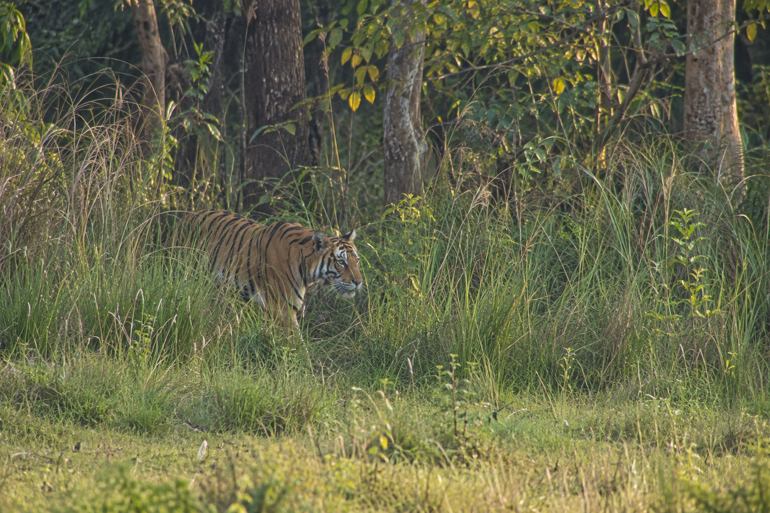
Grassland and woodland meet in Chitwan, where vegetation shapes both prey feeding areas and cover for a stalking tiger. · AI-generated illustration
What makes land usable as a tiger hunting ground? A patch of forest may look suitable on a map, yet offer few chances for a tiger to approach prey unseen. Open grassland may support grazing deer but provide little concealment where the vegetation is short. To understand tigers in Chitwan National Park, we need to look beyond the amount of land protected. The central question is how that land brings prey, cover and opportunities for a close approach together.
Chitwan lies in Nepal’s lowland Terai, where sal forest, riverine woodland, grassland and wetlands form a varied landscape. These habitats are not separate rooms with fixed boundaries. Rivers reshape their margins, seasonal growth changes vegetation, and animals move between feeding and resting places. For a tiger, the value of this landscape depends partly on how its different parts connect. A place that feeds deer and a place that hides a stalking predator may sit beside each other rather than occupy the same ground.
This distinction matters because a tiger’s hunting needs are more specific than a general need for “wild habitat.” Tigers usually rely on concealment and a close approach rather than a prolonged chase. Finding prey is therefore only part of the task. A tiger must also get near enough to attempt an attack without being detected too soon. Vegetation, visibility and the arrangement of open and sheltered ground help determine whether an encounter can become a hunting opportunity.
Prey animals are making their own choices within the same landscape. Deer seek food, but they also need places to rest and ways to detect danger. Wild boar use a range of habitats as they forage and seek shelter. Their movements do not simply follow whichever area looks greenest. Food availability, water, cover and disturbance can all influence where they spend time. Tiger hunting habitat emerges from these overlapping needs, not from vegetation alone.
Habitat structure means the physical arrangement of a place: how tall or dense its vegetation is, how much can be seen through it, and how patches of cover relate to open ground. This is different from merely naming a habitat type. Two stretches of forest can offer very different conditions near ground level. Likewise, a grassland can contain both exposed feeding areas and dense stands that obstruct sight. Broad labels are useful, but they cannot fully describe the conditions a tiger encounters while stalking.
Time adds another layer. A hunting landscape is not equally useful throughout the year, or even throughout a day. Seasonal flooding and vegetation growth can alter access and concealment, while prey movements change where encounters are likely. This does not mean that every change helps or harms tigers in a predictable way. It means that habitat quality must be understood as a changing relationship between animals and their surroundings, rather than a permanent rating attached to one patch.
That relationship also makes conservation more demanding than preserving a forest outline. A protected area can retain its boundaries while conditions within it change. If prey become scarce, useful cover disappears, or disturbance makes important places difficult to use, land may lose some of its hunting value without looking dramatically different from a distance. Equally, open habitats should not be dismissed as empty spaces simply because they lack trees. Their role in supporting prey may be essential to the wider system.
The ecological focus, then, is on a working hunting landscape: one that supports prey and allows tigers to find and approach them. Understanding tigers in Chitwan National Park begins with asking how these functions fit together. That question offers a clearer foundation for conservation than judging habitat by its appearance or forest cover alone.
Chitwan’s Habitat Mosaic: More Than Forest Cover
Chitwan’s lowland landscape is not one continuous wall of jungle. It is a shifting patchwork of sal forest, riverine woodland, alluvial grassland and river margins. These habitats differ in height, density, ground cover and exposure to water. To understand the landscape of tigers in Chitwan National Park, it helps to picture both its horizontal pattern—the patches beside one another—and its vertical layers, from ground vegetation to tree canopy.
Sal Forest: The Broad Woodland Framework
Sal forest forms much of Chitwan’s wooded framework, especially on relatively well-drained ground away from the most frequently flooded river edges. Sal trees dominate these stands, but the habitat is not uniform. Canopy gaps, drainage lines, slopes and differences in soil moisture create variation within the forest.
Where crowns close overhead, shade limits some ground vegetation. Where light reaches the soil, shrubs, saplings and grasses can form a thicker lower layer. Seasonal leaf fall also changes the forest floor and the amount of light passing through the canopy. A map labelled simply “forest” misses these differences in structure.
Riverine Forest: Woodland Shaped by Water
Riverine forest occupies land influenced by rivers and their floodplains. Compared with established sal stands on better-drained sites, these woodlands often grow on younger alluvial soils: material carried and deposited by flowing water. Khair and sissoo are characteristic trees in parts of this river-associated vegetation, though species composition changes with local conditions and the age of a stand.
Riverine woodland may appear as narrow strips, irregular islands or broader patches beside former channels. Some stands are young and relatively open; others have taller trees and a developed understorey. Their boundaries are often uneven because water does not deposit soil or erode banks in straight lines.
Alluvial Grassland: Open Ground with Many Layers
Alluvial grasslands occupy parts of the floodplain, including surfaces where river activity has interrupted woodland development. “Open” here means lacking a continuous tree canopy, not necessarily having short or sparse vegetation. Tall grasses can create dense stands, while other patches remain lower or more broken.
Differences in drainage, soil texture and time since disturbance help shape this variety. A shallow depression may retain moisture longer than a nearby sandy rise. Grassland can therefore contain wet hollows, dry patches, scattered shrubs and emerging trees within a small area. These internal features matter as much to its physical character as its overall extent.
River Margins: A Moving Boundary
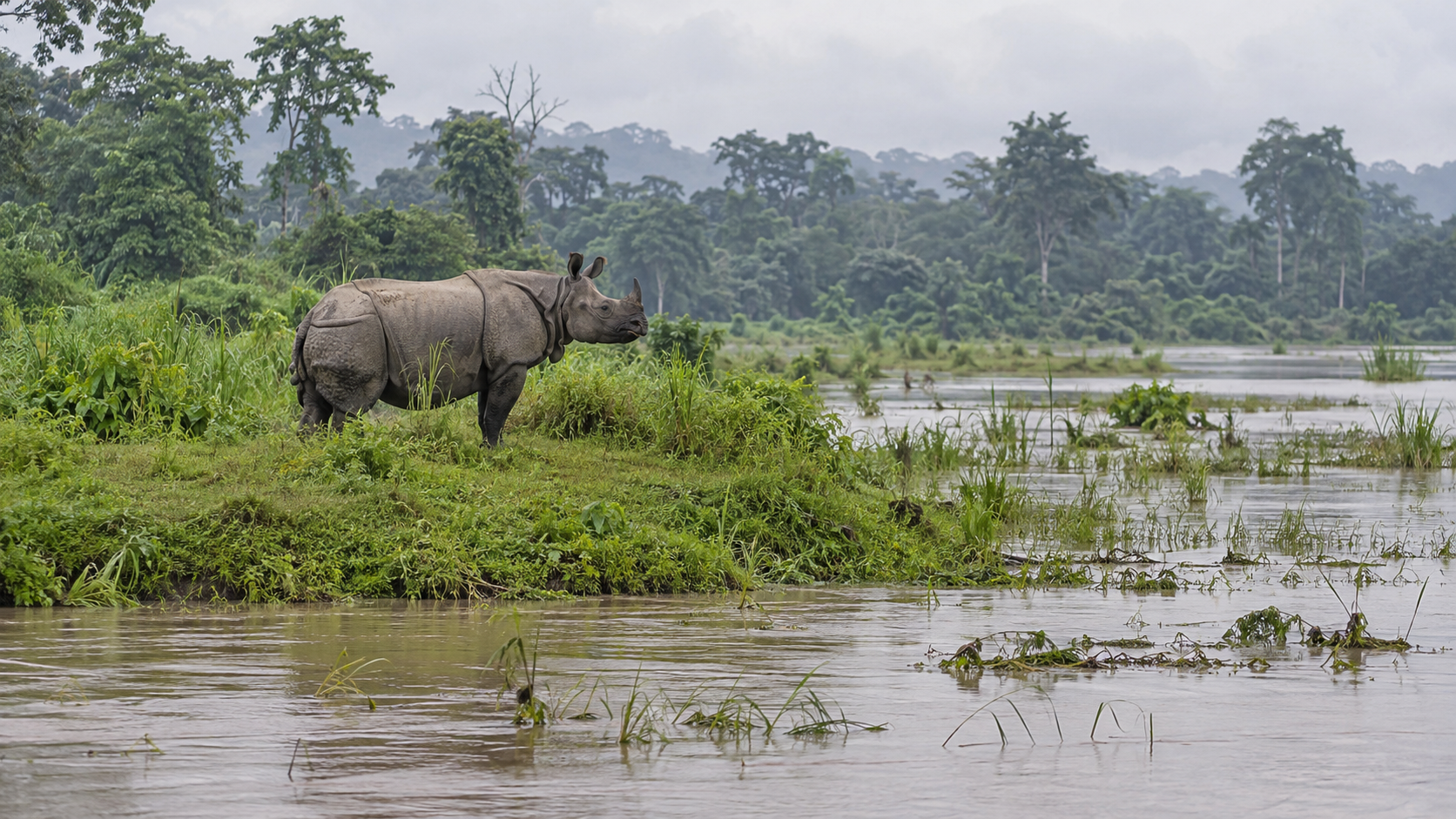
Along the Rapti, Narayani and other waterways, river margins link flowing water with terrestrial habitats. Exposed sand and gravel bars, muddy banks, side channels and low terraces form a zone that can change markedly between seasons. During lower flows, bare surfaces become visible; when water rises, some are submerged or reshaped.
These edges are not fixed borders. Channels can shift, banks can collapse, and side channels can become cut off from the main flow. A place that is dry ground in one period may later become part of an active channel.
Floods and Succession Keep the Mosaic Changing
Monsoon flooding does more than add water. It can scour vegetation, remove soil and leave fresh deposits of sand, silt or gravel elsewhere. The resulting surfaces differ in elevation, moisture and stability, creating new starting points for plant growth.
Vegetation succession is the gradual change that follows as plants establish and conditions develop. On some stable surfaces, grasses and other early vegetation may give way to shrubs and trees. Repeated flooding can interrupt or reverse that process. Fire, cutting and grassland management also influence the direction of change. Chitwan’s mosaic is therefore best understood as a landscape in motion, rather than a permanent arrangement of forest and grassland.
Where Prey Feed, Shelter and Gather
For tigers in Chitwan National Park, a landscape’s value depends partly on where prey find food, shelter and water. Chital, sambar and wild boar are important prey, but they do not use every patch in the same way. Their movements create an uneven food supply for tigers: one grassy opening may draw feeding animals, while a nearby stretch of forest offers shelter but little forage at that moment.
Different Animals, Overlapping Needs
Chital, also called spotted deer, often feed in grasslands, clearings and woodland edges. Fresh grass can make a patch attractive, although chital also eat leaves, shoots and other plant material. Nearby trees provide shade and cover, allowing deer to move between feeding and resting places. A clearing beside woodland may therefore serve several needs within a short distance. However, chital are not restricted to edges, and their use of a site changes with forage quality, disturbance and season.
Sambar are larger deer that commonly use wooded habitats and dense cover. They browse leaves, twigs and shoots, while also eating grasses and other available plants. Forest undergrowth can supply both food and shelter, so an area that looks less productive than an open meadow may still support them. Sambar also visit water and may wallow. Their movements between cover, feeding patches and water can bring them into habitats also used by chital, despite differences in their usual feeding habits.
Wild boar are flexible feeders. They root for underground plant parts and eat fruits, seeds, invertebrates and other available foods. Moist ground, fallen fruit or a temporary flush of food can make a particular patch worth revisiting. Thick vegetation offers resting cover, while water and muddy wallows help them cool themselves. Boar may forage in grassland, woodland and riverine areas; describing them as animals of just one habitat would miss much of their flexibility.
Why Prey Gather in Some Places
Food is not spread evenly through Chitwan’s habitat mosaic. The amount of grass matters, but so do its freshness, nutritional quality and accessibility. Tall, mature growth is not automatically better feeding habitat than a smaller patch of young shoots. Likewise, woodland can vary greatly in the amount of edible undergrowth or fallen fruit it provides. Different prey species respond to different parts of this food supply.
Water adds another layer. During drier periods, remaining water sources can influence where animals travel and gather. Yet a riverbank or waterhole is not guaranteed to hold prey throughout the day. Shade, nearby forage, safe approaches and human activity all affect its use. When water becomes more widely available after rain, animals may have more options rather than returning to the same few places.
Flooding can temporarily remove feeding grounds, redirect movement or leave fresh growth as water recedes. Local vegetation management can also change feeding opportunities. These shifts mean that a productive prey patch is not necessarily productive all year. Prey availability is a moving pattern, not a fixed map.
Abundance Is Not the Same as Accessibility
A high total number of prey animals does not tell us how many a tiger can realistically catch. Animals may be concentrated outside an individual tiger’s usual range, separated from it by disturbance, or feeding where an approach is difficult. A large, alert chital herd in an exposed clearing may be less accessible than its visibility suggests.
Accessibility also changes with prey size, condition, group behaviour and the timing of encounters. Large sambar and adult wild boar can be dangerous to attack. Even suitable prey may pass through a site only briefly. Understanding the prey base therefore requires two questions: how many animals live here, and when and where do they become available to a tiger?
From Concealment to Ambush: How Tigers Use the Mosaic
For tigers in Chitwan National Park, finding prey is only part of the hunt. A tiger must also approach without being detected, reach a useful striking distance and respond before its target escapes. The arrangement of tall grass, shrubs, trees and open ground can therefore matter as much as the presence of deer. A prey-rich patch is not automatically an easy place to catch a meal.
Cover Helps Close the Gap
In general tiger hunting ecology, concealment supports a slow approach followed by a short, powerful attack. Tigers are not built to pursue alert deer over long distances. They benefit when vegetation or the shape of the ground allows them to reduce the gap before revealing themselves. Grass stems, leafy undergrowth and uneven terrain can break up a tiger’s outline, although none makes it invisible.
Visibility works both ways. A feeding deer needs enough warning to flee, while a tiger needs enough information to judge the animal’s position and movement. Dense cover can hide a predator but also obstruct its view or complicate its final approach. More vegetation does not always mean better hunting: the useful feature is a combination of concealment, access and a workable line of attack.
Approach distance is therefore important, but there is no single distance that guarantees success. Prey species, alertness, wind direction, footing and obstacles all influence an encounter. Sound and scent can expose a tiger before it is seen. Even a well-concealed approach may end without an attack if the prey moves away or the opportunity becomes poor.
The Opportunity—and Risk—of Feeding Openings
Grassland openings offer an important trade-off. Fresh growth can attract grazing animals, but open ground may give those animals clearer views of approaching danger. A tiger beside such an opening could have access to abundant prey yet lack a concealed route close enough to attempt an ambush. The distance between the feeding animals and usable cover matters more than a simple label such as “grassland” or “forest.”
Nearby tall grass, scrub or woodland undergrowth may provide a hidden approach. However, not every habitat edge is a hunting hotspot. Some boundaries are exposed, heavily disturbed or separated from feeding areas by ground that offers little concealment. Prey may also remain well away from cover or become especially vigilant near it. An edge is a potential opportunity, not evidence that kills regularly occur there.
The same patch can also change in usefulness. Seasonal vegetation growth, flooding, grazing and grassland management can alter sightlines and access. A route that offers concealment at one time may be exposed at another. This explains why habitat structure deserves attention alongside habitat type, without assuming that any particular change improves hunting everywhere.
What Can We Say Specifically About Chitwan?
Research in Chitwan has documented tiger diets that include wild ungulates such as chital, sambar and wild boar. This establishes the importance of these prey animals, but diet evidence alone does not reveal how each animal was stalked or where it was killed. Finding prey remains in scat cannot show whether an attack began in tall grass, woodland or an opening.
The stalking principles described here come from general tiger ecology; they should not be presented as direct observations of every Chitwan hunt. Likewise, a camera-trap image records a tiger’s presence, not necessarily hunting behaviour. Establishing local ambush patterns requires evidence that connects the predator, prey and encounter site.
The careful conclusion is that Chitwan’s mosaic offers different combinations of prey access, concealment and visibility. Understanding how those features work together is more useful than treating all dense vegetation as ideal cover or every forest–grassland boundary as a proven killing ground.
When Hunting Habitat Becomes Fragmented or Disturbed
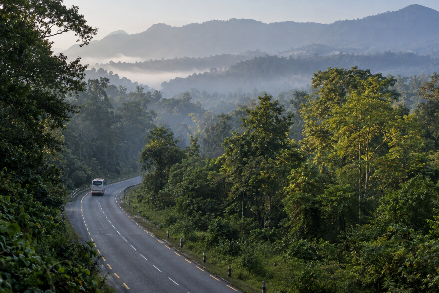
A forest patch can look suitable on a map yet be difficult for a tiger to reach safely. Between resting cover and a prey-rich grassland may lie a road, an open field or a busy settlement edge. For tigers in Chitwan National Park, the value of habitat therefore depends partly on the routes connecting it. Disturbance need not remove vegetation to weaken those connections; it can make crossing more risky or restrict movement to quieter periods.
Roads Can Change More Than Forest Cover
A road’s effect depends on its location, traffic, speed and surrounding cover. A quiet track is not equivalent to a busy route cutting across a movement corridor. Vehicles can interrupt crossings and create collision risks, while roadside activity may bring people into areas that were previously less accessible. Where a road separates shelter from feeding grounds used by prey, a tiger may have to wait, take a detour or cross under less favourable conditions.
These effects are not always obvious from a forest-cover map. Two wooded areas may appear connected even when the strip between them carries frequent traffic or offers little concealment. Conversely, a narrow connection may remain useful if it retains cover and has limited disturbance. Habitat area measures how much space exists; it does not show how safely animals can move through that space.
Settlement Edges and Repeated Activity
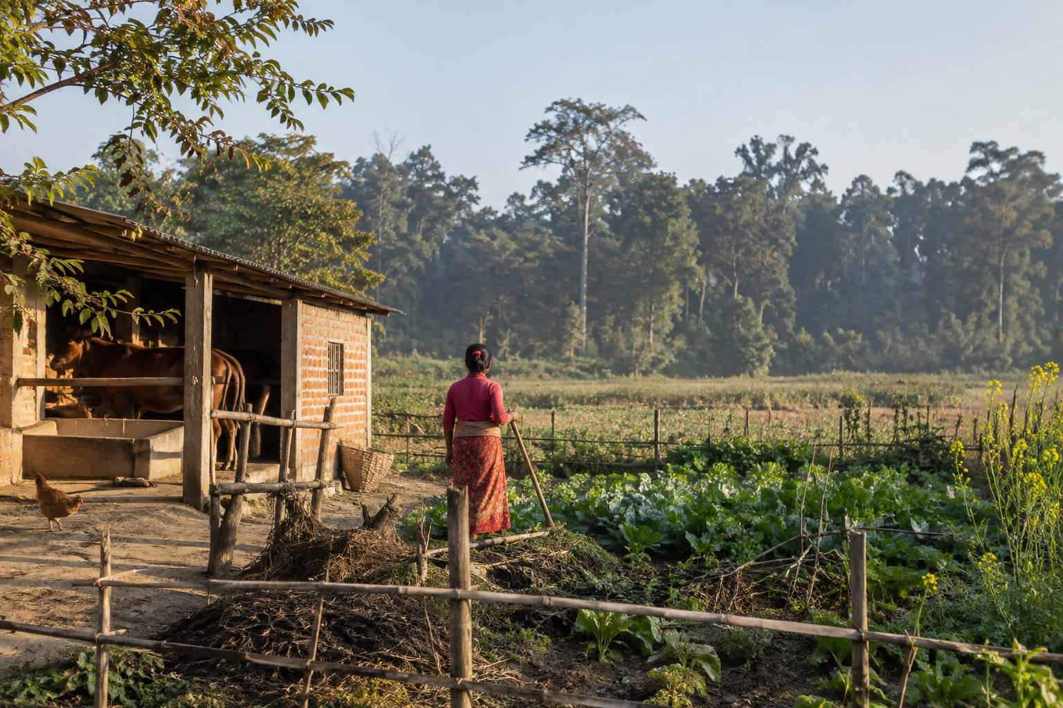
At settlement edges, houses, cultivated fields, paths and remaining vegetation can form a complicated boundary rather than a clean line between people and wildlife. A tiger may still use nearby cover, but its access can vary with farming, fodder collection and other daily activities. Repeated encounters or interruptions may reduce the hours when a route is usable without necessarily making the animal abandon it altogether.
Timing matters as much as presence. Occasional passage along one path may have a different effect from people and vehicles arriving throughout the day and night. Tigers can sometimes adjust their movements to avoid people, but that flexibility should not be mistaken for freedom from pressure. Waiting or changing routes can constrain access to hunting areas, especially where few alternative connections remain.
Grazing Can Affect Both Prey and Encounters
Livestock grazing can influence habitat in several ways. Where grazing is intensive, it may reduce vegetation available to wild herbivores or alter low cover used for concealment. The outcome depends on grazing intensity, season, vegetation and the wild prey species involved. Herding also brings people and domestic animals into places that tigers or their prey may use, increasing opportunities for close encounters.
At park–buffer-zone interfaces, livestock may be exposed while grazing near cover, moving along wooded routes or staying in poorly protected enclosures. A tiger encountering an accessible domestic animal may attack it even where wild prey remains available. Livestock predation is therefore not, by itself, evidence that a tiger has run out of natural prey. Access, opportunity and the circumstances of an individual encounter also matter.
Read Conflict in Its Local Context
For households, losing livestock can mean a serious loss of income or security. Attempts to recover an animal, approach a feeding tiger or drive it away can also put people at risk. Such incidents can deepen fear and resentment, making an already difficult shared boundary harder to manage.
Understanding the pressure requires looking beyond the location of a sighting or attack. Which routes remain open? When is disturbance greatest? Where were livestock kept, and what cover was nearby? Evidence about wild prey, crossing points and repeated incidents helps distinguish a movement bottleneck from an exposed livestock situation. Edge use alone answers none of these questions: it must be interpreted within the surrounding landscape.
Protecting a Working Hunting Landscape
Protecting tigers in Chitwan National Park means keeping a landscape that supports prey, provides stalking cover and allows animals to move safely. More tree cover is not automatically better habitat: grassland, riverine forest, woodland and wetlands perform different jobs. Conservation should protect this variety rather than push every patch towards the same vegetation type.
Manage grasslands as patches, not empty spaces
Grassland cutting and controlled burning can maintain feeding areas for deer and other herbivores. However, their value depends on timing, location, frequency and the cover left behind. Clearing a large area at once may produce fresh growth but temporarily remove shelter. Repeated treatment without checking results can also favour unwanted plants or damage recovering vegetation.
Locally informed, rotational management is more useful than blanket clearance. Park staff, grassland specialists and nearby communities can identify where woody growth is closing grassland, where prey feed and which patches should remain untreated as refuge. Burning requires trained teams, suitable conditions and safeguards for wildlife and neighbouring settlements. Current cutting permissions, burn schedules and community access arrangements vary; check locally with park authorities.
The invasive vine Mikania micrantha adds another challenge, particularly in moist, disturbed habitats. It can smother native vegetation and reduce accessible forage. Removing it once is rarely enough: follow-up inspection and treatment of regrowth matter. Control should avoid unnecessarily damaging native plants or spreading plant fragments. Managers should judge success by recovering native vegetation and prey use, not simply by the area cleared.
Protect prey, rivers and connections together
Wild prey protection needs effective anti-poaching work alongside habitat management. Patrol information can reveal snares, illegal hunting and repeated disturbance, while community partnerships help address pressures beyond patrol routes. Livestock grazing in sensitive areas can compete with wild herbivores and bring domestic animals closer to tiger hunting grounds. Responses should consider local dependence on forest resources rather than rely only on restrictions.
The Rapti, Narayani and their associated channels help renew Chitwan’s floodplain mosaic through flooding, erosion and sediment deposition. Protecting habitat therefore includes assessing embankments, extraction and other river interventions for their effects on channels, wetlands and grasslands. Flood protection for people remains essential, but engineering decisions should consider wildlife habitat rather than treat river movement only as a problem.
Connections towards neighbouring forests, including the wider Chitwan–Parsa–Valmiki landscape, are equally important. A corridor must offer usable cover and manageable risk, not merely appear green on a map. Roads, settlements and intensive activity can weaken its function. Infrastructure planning should protect movement routes, with crossings and traffic controls designed around evidence of animal movement.
Reduce conflict and measure what works
Disturbance reduction should target sensitive places and periods: repeated vehicle stopping, crowded wildlife sightings and unnecessary activity near cover can undermine habitat quality. Around settlements, stronger night-time livestock enclosures, supervised grazing and prompt reporting of tiger presence can reduce exposure. Rapid-response support and accessible compensation procedures also matter; check locally for current reporting routes and eligibility rules.
Monitoring should connect management actions with outcomes:
- Prey: track abundance and distribution, not just sightings beside roads.
- Vegetation: measure native grass recovery, cover structure and invasive regrowth after treatment.
- Tiger movement: use repeated camera-trap surveys and, where authorised, telemetry to assess habitat and corridor use.
- Conflict: record livestock losses, human encounters and response outcomes, including location and circumstances.
Useful evidence includes the Department of National Parks and Wildlife Conservation’s Status of Tigers and Prey in Nepal 2022, National Trust for Nature Conservation’s Chitwan research and monitoring updates, and the park’s current management plan and annual programmes. The national survey provides a baseline, not a real-time picture. Consult newer local findings and check locally for changing practices before recommending interventions.
Conclusion: Judge Habitat by How It Functions
The future of tigers in Chitwan National Park depends on more than keeping a landscape green. Habitat must allow a predator to make a living. A tiger needs wild prey, a concealed approach and safe routes between places where it can hunt. These needs are connected: a feeding ground loses value if a tiger cannot reach it safely, while dense cover offers little hunting opportunity if prey are scarce. Conservation succeeds when those connections remain useful on the ground.
This gives managers, conservation groups and visitors a practical question to ask: can tigers find wild prey, approach it through suitable cover and move safely between hunting areas? Each part matters. Protecting one while neglecting another can leave a landscape that looks suitable but works poorly. The test shifts attention from the presence of habitat features to what those features allow animals to do.
Three Questions for a Working Landscape
- Can tigers find wild prey? Assessing habitat means looking beyond whether prey animals are present. They need places to feed, shelter and reach water without being repeatedly displaced. The useful question is whether these needs can be met across the landscape, not simply whether animals gather at a particular viewing spot. Conservation should support the conditions that sustain wild prey, rather than judge success by how easily visitors see them.
- Can tigers approach through suitable cover? Prey availability alone does not make a hunting area effective. Tigers also need opportunities to close the distance without being detected too early. Grass, scrub, forest edges and other cover should therefore be considered in relation to nearby prey habitat. Neither maximum tree cover nor maximum openness is a sensible goal everywhere. What matters is whether the arrangement supports both prey and a tiger’s concealed approach.
- Can tigers move safely between hunting areas? A productive patch cannot be judged in isolation. Its value also depends on the routes leading into and out of it. Movement must remain possible without forcing tigers through avoidable disturbance or dangerous encounters with people. A connection that exists on a map needs scrutiny on the ground: can an animal actually use it safely?
These questions provide a way to weigh management choices without assuming that every intervention helps. Before changing vegetation, expanding visitor access or approving activity near a movement route, ask which part of the hunting system the decision supports—and which part it might weaken. A local improvement can carry a wider cost. Making one area more accessible to people, for example, should not be treated as harmless simply because its trees remain standing.
The same test encourages a more useful response when habitat appears to be underperforming. Instead of assuming that more planting or stricter protection in one patch is always the answer, identify the missing function. Is the problem prey habitat, insufficient concealment, interrupted movement or disturbance? The response should address that weakness while keeping the wider system intact. This makes conservation a task of maintaining relationships, not merely protecting separate pieces.
Forest acreage and tiger counts remain useful measures, but neither tells the whole story alone. Acreage describes extent, not necessarily hunting value. A count records animals, not every condition needed to sustain them. Chitwan should therefore be judged as a functioning ecological landscape: one where prey can meet their needs, tigers can hunt and movement remains safe. The goal is not simply space containing tigers, but connected habitat that continues to work for them. That is the distinction between protecting a visible symbol of conservation and protecting the living system behind it.