Wildlife & Conservation
Where Can Wildlife Cross Safely? Investigating Roads Around Chitwan
EverestBlog AI · Oct 30, 2026 · 15 min read
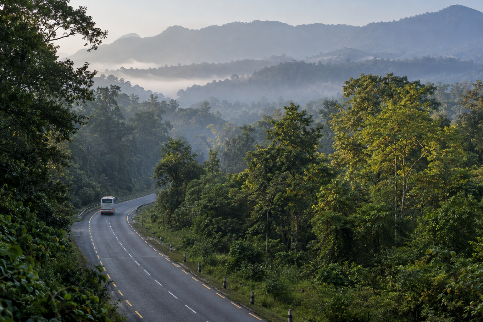
Road safety for wildlife depends on connected habitat, suitable passages and maintenance—not crossing structures alone. · AI-generated illustration
A forest can look continuous from a distance while being divided at ground level. Around Chitwan National Park, roads carry buses, trucks, motorcycles and visitors through a landscape used by wild animals. For an animal seeking food, water, cover or a mate, crossing the carriageway may be part of an ordinary journey. For a driver, that movement can become visible only in the final seconds.
The important question is not simply whether wildlife crosses roads. It is whether animals can cross without being killed, frightened back or separated from habitat they need. Investigating Chitwan wildlife road crossings means looking beyond warning signs to road design, monitoring records and maintenance responsibilities.
This article draws together established landscape context and reported mitigation, rather than claiming a fresh roadside survey. It identifies broad areas of concern without publishing sensitive crossing coordinates. Conditions, construction plans and access rules change, so check locally before visiting or relying on a particular route.
1. The park boundary is not the movement boundary
Chitwan National Park protects an important part of Nepal’s lowland habitat, but animals do not arrange their movements around its legal boundary. Forest patches, riverbanks, wetlands and adjoining protected landscapes all contribute to movement beyond the park itself.
The Barandabhar forest corridor is especially important to this discussion. It connects habitat around Chitwan with forests towards the north, helping maintain a broader landscape rather than an isolated protected area. Roads passing through this connection therefore matter even where they do not enter the national park.
A useful investigation begins with habitat on both sides of a road. Does an apparent crossing connect substantial forest, or lead into a settlement? Is a wetland separated from cover? Could future roadside development close an approach that remains open today?
A crossing is only as useful as the habitat it connects. Protecting the opening while losing its approaches can leave a technically complete structure with little conservation value.
2. Where crossing risks are documented
The strongest starting point is the Barandabhar landscape, where road ecology research has examined wildlife mortality and the effects of roads on habitat connectivity. The East–West Highway crosses this forest connection, making the relationship between traffic and animal movement a documented concern rather than a hypothetical one.
The Narayanghat–Mugling road is another important focus. Its southern forested sections sit within the wider Chitwan movement landscape, and wildlife underpasses were incorporated during road improvement. Their presence reflects recognition that an upgraded transport route needed measures for animal passage.
These are broad investigation areas, not a public map of animal routes. Risk changes within each road according to forest cover, drainage, traffic, visibility and development.
Reports of a collision elsewhere around Chitwan may justify attention, but one report does not establish a persistent hotspot. A careful article should distinguish a documented collision location, a repeatedly affected stretch and a predicted movement corridor. They answer different questions.
3. What the available evidence can establish
Evidence comes in several forms: published research, environmental assessments, park or forest records, road project documents and monitoring by conservation organisations. Each can help, but none should be treated as a complete record of everything happening along the road.
A research survey may cover particular seasons or selected road sections. An official incident register may contain only animals reported to staff. A project report may describe structures delivered without measuring whether those structures reduced collisions.
Before repeating a finding, ask what was measured, where, for how long and by whom. Ask whether the report describes conditions before road widening, during construction or after traffic resumed. Those periods are not interchangeable.
The public evidence supports concern about fragmentation and road mortality around Chitwan, alongside the existence of mitigation. It does not justify declaring every forest road dangerous to the same degree, or every installed passage successful. The strength of a claim should match the strength of its supporting observations.
4. Roadkill records tell only part of the story
A dead animal provides clear evidence that a crossing attempt failed. However, recorded carcasses are an incomplete measure of the road’s effects. Small animals can disappear quickly through scavenging, traffic damage or roadside clearance. Injured animals may leave the carriageway and never enter a roadkill register.
Survey methods also matter. A person walking a short stretch can notice casualties missed from a moving vehicle. Visits after long intervals are less likely to capture brief evidence. Unequal effort can make one road appear worse simply because somebody looked more carefully there.
Monitoring should record search frequency, survey distance, animal identification and uncertainty. Sensitive locations can remain restricted while aggregated findings are published.
A falling carcass count is encouraging only when interpreted alongside other evidence. It could mean safer passage, but it could also mean fewer animals remain nearby or that animals have stopped attempting to cross. These possibilities require very different conservation responses.
5. A road can block wildlife without killing it
Collisions are the most visible harm, but avoidance can be equally important. Noise, headlights, fast traffic and open pavement may discourage animals from leaving cover. A road can become a barrier even when recorded deaths are few.
That barrier may reduce access to seasonal resources or make it harder for animals to move between breeding populations. The concern is not that every individual must cross every road. It is that a functioning landscape needs enough safe movement to remain connected over time.
Different species experience the same road differently. An opening comfortable for a small mammal may be unsuitable for a large one. Reptiles and amphibians face challenges that a camera aimed at larger mammals may barely register.
Evaluation therefore needs a broader question than “How many animals died?” It should also ask which animals still move through the landscape, which avoid the road and whether mitigation serves more than a few easily photographed species.
6. Traffic conditions shape the danger
Road width is only one part of crossing risk. Vehicle speed, traffic volume, bends, gradients, roadside vegetation and visibility all affect how much time a driver and an animal have to react. An animal emerging from cover may be difficult to see even on a familiar route.
Night traffic introduces another challenge. Headlights illuminate a limited area, while glare and darkness can make distance difficult to judge. Wildlife movement also varies by species and season, so a universal claim about the safest crossing hour would be misleading.
Reliable investigation pairs animal observations with traffic information collected over the same period. Otherwise, an apparent change in animal behaviour might be wrongly attributed to a new structure when traffic conditions have also changed.
Drivers should follow posted limits and official instructions. Where wildlife measures include lower speeds or controlled movement, the important test is whether those measures are enforced and maintained, not merely announced on a sign.
7. What mitigation already exists
Wildlife underpasses on the Narayanghat–Mugling road are an established example of transport mitigation in the Chitwan landscape. Public reporting and conservation monitoring have described wild animals using these passages. That is meaningful evidence that at least some animals accept an alternative to crossing the road surface.
However, “an animal used the underpass” and “the road is now safe” are different statements. Use does not reveal how many animals still cross above, whether collisions declined or whether some species avoid the structure altogether.
Drainage culverts and bridge openings may also provide opportunities for movement. They should not automatically be counted as effective wildlife crossings simply because an animal could physically fit beneath them.
For any existing measure, ask for its intended function, present condition and monitoring record. Current structure inventories, maintenance status and access arrangements should be checked with the responsible road authority and conservation offices. A photograph from completion day cannot establish how a passage performs years later.
8. What makes an underpass usable?
An underpass must offer more than empty space beneath concrete. Its dimensions, openness, substrate, visibility and approaches all influence whether animals enter. The appropriate design depends on target species, terrain, water movement and the habitat on either side.
Animals may hesitate where entrances are exposed, brightly lit or crowded by people. A passage leading towards a wall, building or busy access track may offer little practical connection. Human activity nearby can undermine a structure without physically blocking it.
Good design also considers the smaller movements that receive less attention. A dry route beside flowing water may matter, while smooth surfaces, deep channels or sudden drops can create obstacles for some species.
These are design questions, not a recommendation for visitors to inspect entrances. Approaches should remain quiet and undisturbed. Professional assessment can document physical conditions without turning a movement route into an attraction or circulating information that increases pressure on wildlife.
9. Drainage and maintenance can decide success
Chitwan’s monsoon conditions make drainage central to crossing performance. An opening that looks suitable in dry weather may fill with water, sediment, debris or eroded material during heavy rain. Access ramps can wash out even when the main structure remains intact.
A culvert designed primarily to convey water may offer occasional animal passage, but its ecological usefulness can change sharply with flow. Engineers and ecologists need to examine both functions rather than assuming one automatically serves the other.
Maintenance should include the approaches as well as the structure. Blocked entrances, dumped waste, damaged drainage and stored construction materials can reduce usable space or discourage movement.
The practical question is who inspects these problems and who pays to fix them. A maintenance schedule should specify responsibility, reporting procedures and follow-up. Inspection after major storms is especially important. Without an operating budget, even thoughtful wildlife infrastructure can deteriorate into a feature that exists on paper but fails on the ground.
10. Fences and warning signs need scrutiny
Fencing can guide animals towards a safe passage and reduce access to the carriageway. But it must be designed with the crossing system, not added as an isolated barrier. Poorly placed fencing can interrupt movement while leaving animals exposed at gaps or ends.
Different species climb, dig, push through or become trapped by different materials. Drainage channels and access roads create further weak points. Maintenance therefore matters as much as the original specification.
Warning signs serve another purpose: they alert drivers to a known concern. Their value depends on visibility, placement, driver response and supporting enforcement. A faded sign beside fast traffic is not equivalent to effective speed management.
Investigators should ask whether road managers have measured driver speeds or collision patterns before and after these measures. Neither fencing nor signage should be dismissed, but neither should be accepted as proof of safety. The relevant outcome is safer movement, not the number of items installed.
11. Construction creates its own crossing problems
Road widening and repair can temporarily change a landscape before the finished design is available. Excavations, spoil heaps, machinery, temporary access tracks and work camps may block routes that animals previously used. Work lighting and noise can push movement towards other road sections.
An environmental assessment should therefore address construction as well as operation. Contractors need clear instructions on keeping designated passages open, managing waste and preventing materials from accumulating at approaches.
Temporary traffic diversions deserve attention too. Moving vehicles onto another alignment may shift risk rather than remove it, particularly where the alternative passes through forest or alongside water.
Useful evidence includes inspection records, photographs taken for authorised monitoring and documented responses to noncompliance. An approved plan is only a starting point. The public-interest question is whether its requirements reached the worksite and whether someone had the authority to stop or correct damaging practices. Current works and travel restrictions should always be checked locally.
12. Who is responsible for evaluating crossings?
Responsibility is shared, but it should not be vague. For national highways, the Department of Roads and the relevant project or maintenance office are central to engineering, construction and upkeep. Other roads may fall under provincial or local authorities.
Chitwan National Park and the Department of National Parks and Wildlife Conservation bring protected-area responsibilities and wildlife expertise. Division Forest Offices are important where affected habitat lies within their jurisdiction outside the park. Traffic police contribute to speed enforcement and incident response.
Researchers and organisations such as the National Trust for Nature Conservation and WWF Nepal have relevant conservation expertise. Their involvement in a specific crossing, however, should be confirmed rather than assumed.
Independent evaluation can complement government and project monitoring. The key is to identify who designed the measure, who built it, who maintains it and who judges its results. Those roles may overlap, but transparent reporting helps readers understand possible gaps and conflicts of interest.
13. Camera traps show use, not complete success
A camera image of wildlife inside an underpass is valuable. It confirms use at that moment and can help identify species, direction of travel and patterns across the monitoring period. Repeated observations can reveal more than a single celebrated photograph.
Still, camera records require interpretation. Several images might show the same individual. A camera may miss small animals or fail during bad weather. Different settings and placement can produce different detection rates.
Monitoring should explain camera effort, equipment failures and how separate events were defined. Where possible, observations near approaches and other road sections help show whether animals use the passage instead of the carriageway.
Use is a necessary clue, not a complete verdict. A stronger evaluation combines passage monitoring with roadkill surveys, habitat assessment and traffic data. Images released publicly should also be checked for sensitive location information. Conservation evidence need not become a guide to finding animals at vulnerable points.
14. What would convincing success look like?
A strong evaluation begins before construction, establishing how animals move and where mortality occurs. Monitoring after installation can then test change. Comparable stretches without the intervention can help separate the crossing’s effect from wider changes in traffic or wildlife abundance.
In practice, baseline data are sometimes missing. That does not make evaluation impossible, but it limits what can honestly be claimed. Researchers should describe those limits rather than presenting a simple before-and-after story without a reliable “before”.
Success should include reduced collision risk and continued movement through suitable habitat. It should also consider which species benefit, whether passages remain usable through wet and dry seasons and whether roadside development is weakening the connection.
Findings need to feed back into management. If monitoring reveals avoidance, flooding or mortality near fence ends, the response may require design changes. Evaluation is most useful when it leads to corrective work, not when it finishes as an unread report.
15. The documents that make accountability possible
Readers seeking evidence can ask road agencies and conservation offices for environmental assessments, approved management plans, crossing design summaries and monitoring reports. For a funded upgrade, project disclosure pages may also hold relevant documents.
Requesting the latest version matters. A preliminary drawing may differ from what was built, while a completion report may not include later maintenance problems. Ask whether a recommendation was approved, funded, constructed and inspected; these are separate stages.
- What wildlife movement evidence informed the crossing design?
- Which agency accepted responsibility after construction?
- What monitoring has been completed, and over which seasons?
- What problems were identified, and what corrective work followed?
Public summaries can answer these questions without exposing exact animal routes. Where records are unavailable, say so. Lack of a public report does not prove that no monitoring occurred, but it does make independent scrutiny harder. Transparent, non-sensitive results would help communities judge whether promised protection became effective infrastructure.
16. Future transport plans need early scrutiny
New alignments and widening proposals should be examined before routes become fixed. Avoiding an important habitat connection can be more effective than trying to repair fragmentation later with a small number of structures.
The assessment should consider alternatives, including whether an existing transport corridor can meet the need with less ecological damage. It should also examine cumulative effects: a road, railway, access track and roadside development may together create a greater barrier than each project suggests in isolation.
Chitwan has figured in public debates about transport development near sensitive habitats. Specific proposals can change through redesign, review or legal proceedings. Distinguish a proposal from an approved project, and an approval from active construction.
Check locally and consult current official documents before describing project status. The lasting principle is straightforward: wildlife connectivity belongs in route selection and budgeting from the beginning, rather than appearing as an optional addition after engineering decisions are largely settled.
17. How travellers can avoid adding pressure
Visitors do not need to find a crossing entrance to understand this issue. Stopping beside a forest road, walking towards an underpass or waiting for wildlife can obstruct movement and create danger for other road users.
Choose operators who respect traffic rules and do not promise roadside animal encounters. Ask drivers to avoid unnecessary stopping in forested stretches and never request that they chase, surround or illuminate wildlife for photographs.
If an animal appears, give it space and follow official instructions. Do not sound the horn repeatedly to force a crossing. Where an incident or damaged structure needs reporting, contact the relevant road, police, park or forest authority when safely stopped.
Keep precise movement locations out of public posts. Reports sent privately to responsible officials can include useful detail, while public discussion can remain at corridor scale. Responsible travel means allowing the crossing to function, not turning its users into a spectacle.
18. The test is connection, not concrete
Roads around Chitwan serve real transport needs, but their ecological costs cannot be judged from the carriageway alone. A useful investigation follows the whole chain: habitat, movement, traffic exposure, crossing design, maintenance and measured results.
The Barandabhar corridor provides a documented reason for concern, while underpasses on the Narayanghat–Mugling road show that wildlife passage can be included in transport infrastructure. Neither fact supports a simple story of complete failure or complete success.
The next questions are practical. Are the approaches protected? Do passages work through the monsoon? Are collisions being recorded consistently? Can agencies show what monitoring found and what they changed in response?
For Chitwan wildlife road crossings, the strongest evidence of progress will not be a ribbon-cutting photograph or an isolated camera image. It will be a maintained, connected landscape where safer movement is demonstrated, shortcomings are acknowledged and responsibility continues long after the road opens.