
Wildlife & Conservation
Who Shares Chitwan’s River Water? Investigating Dry-Season Decisions Along the Rapti
EverestBlog AI · Oct 30, 2026 · 20 min read
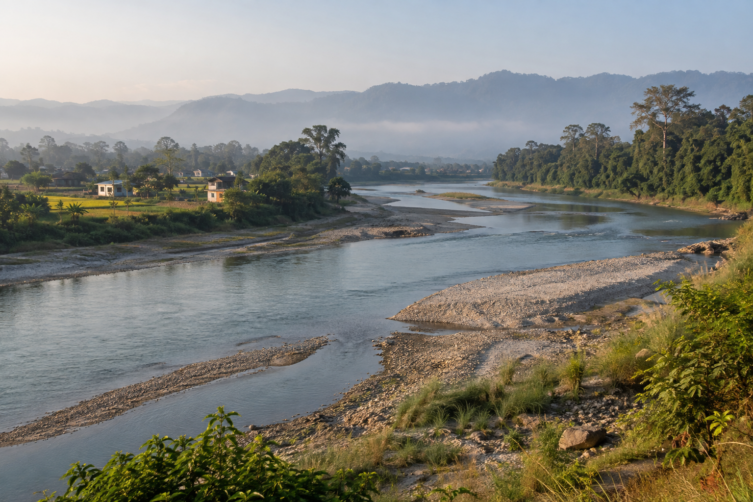
The Rapti connects habitats and livelihoods; understanding dry-season sharing requires records and measurements as well as local experience. · AI-generated illustration
On a dry-season morning beside the Rapti, the river can appear to offer a straightforward picture: exposed sand, a moving channel, fields beyond the bank and buildings set farther back. Yet the water visible from shore reveals little about how decisions are made. A household tap may depend on groundwater. A farm may receive canal water according to a rotation. A lodge may use several sources. Wildlife habitat depends on conditions that cannot be understood from river width alone.
Who shares this water, and who gets heard when demand rises? Those questions lead away from scenic descriptions and towards offices, intake gates, pump records, community meetings and monitoring stations. They also require care. This article sets out an evidence-led investigation of Rapti River water management Chitwan; it does not claim that unpublished allocation records were obtained or that interviews were conducted. Where records are missing, the conclusion must remain open. The task is to establish how water needs are assessed, how decisions are authorised and whether actual delivery matches the rules. A narrow channel, a busy hotel or a struggling crop can provide a starting point, but none proves by itself that someone has taken another user's water.
1. Start with the right river and boundary
The Rapti associated with Chitwan is commonly called the East Rapti, distinguishing it from the West Rapti elsewhere in Nepal. It flows through the Chitwan landscape and joins the Narayani. Along parts of its course, the river is closely connected with Chitwan National Park and neighbouring settlements. Those geographical relationships matter, but they do not create a single, simple water-management boundary.
A river basin, a municipality, a park boundary and an irrigation command area describe different spaces. A decision upstream may affect a reach administered by another office. A well outside the protected area may draw from an aquifer connected to river flow, although that connection requires investigation rather than assumption.
The first reporting tool should therefore be a shared map. Mark tributaries, gauges, drinking-water sources, irrigation intakes, known pumping points, settlements and relevant administrative boundaries. Record where locations came from and when they were checked.
A useful investigation also defines its period: which dry-season months, which year and which river reaches? Without that frame, witnesses may be describing entirely different conditions. Someone discussing a shallow side channel near their village may seem to contradict an official describing average flow across a much larger area. Both accounts could be accurate within their limits.
2. Establish whether there is a shortage
Low water is not automatically a water shortage. Rivers naturally change through the year, while shortages occur when available supply cannot meet a particular need under particular conditions. That need could involve safe drinking water, irrigation delivery or habitat requirements. Each calls for different evidence.
Begin with available river-level and discharge records, rainfall observations and information on upstream withdrawals. Nepal's Department of Hydrology and Meteorology is a starting point for hydrological information; station coverage, access procedures and current data availability should be checked locally.
A water-level reading is not interchangeable with discharge. Converting one into the other usually depends on a relationship developed for the measurement site. Channel movement, sediment and damaged instruments can complicate comparisons. Ask whether the record has been checked and whether gaps or uncertainties are documented.
Then compare reported difficulties with the measured period. Did taps stop during low river flow, or because a pump failed? Did a canal receive less water, or did its distribution become uneven? Did habitat become disconnected, and was that change unusual? Establishing the problem precisely protects everyone from a misleading story. It also makes solutions more specific: repairing equipment is different from changing allocations, and neither should be prescribed before the cause is understood.
3. Follow water from source to user
The river is part of a larger water system, not a pipe feeding every user directly. Households may rely on piped schemes, wells, springs or a combination of sources. Farmers may use gravity-fed canals, pumps or rainfall stored in the soil. Tourism businesses can buy water, use municipal or community supplies, or operate their own sources.
For each user group, trace the route from source to delivery. Record storage, treatment, pumping and any return flow. Water diverted into a canal may partly return downstream or recharge groundwater; water applied to crops may be consumed through evaporation and plant use. These pathways need evidence rather than blanket assumptions.
This distinction matters when comparing demands. A large withdrawal is not necessarily the same as a large net consumption, although its timing and location may still affect other users. Conversely, several small withdrawals can matter together.
A basic source inventory should identify what is measured, what is estimated and what remains unknown. It should also distinguish permitted capacity from actual operation. A pump's rated output says little about seasonal use without operating hours and field checks. Following the water this way makes later arguments about fairness more grounded than simply counting buildings, fields or registered connections.
4. Identify who can make which decision
Water governance in Nepal involves national laws, different levels of government and organisations responsible for particular services. Around the Rapti, relevant actors may include municipalities, provincial water or irrigation offices, drinking-water operators, water-user associations and protected-area authorities. The current responsible office for each scheme or decision should be checked locally.
The key question is not simply, “Who manages the river?” It is, “Who can approve this withdrawal, set this operating rule, inspect this structure or respond to this complaint?” Those powers may sit in different places.
Ask each office for the legal or administrative basis of its role. Request an organisational chart, current contact point and the procedure used when responsibilities overlap. Where an official refers a question elsewhere, record the referral and seek confirmation from the receiving office.
Protected-area responsibilities require particular care. Park and buffer-zone institutions have important conservation and community roles, but that does not mean they control every water supply or irrigation decision in the surrounding landscape. Equally, an infrastructure approval does not settle every conservation obligation. A responsibility map should show both authority and coordination. Otherwise, a complicated problem can become an endless chain of referrals, with no clear record of who must decide or explain an unresolved issue.
5. Read priorities alongside operating rules
Nepal's Water Resources Act provides a national legal framework and sets out an order of water-use priorities, with drinking water and domestic use given precedence. However, a legal priority does not by itself explain daily distribution at a particular intake. Current amendments, regulations and applicable sector laws should be checked against official texts.
Reporting should separate three questions: what the law requires, what a permit or scheme agreement provides, and what operators actually do. These layers may align, but that should be demonstrated.
Request the documents that translate broad duties into operating decisions. They may include licences, approved project documents, water-user agreements, canal schedules, municipal decisions and environmental approval conditions. Not every use necessarily requires the same type of permission; avoid treating an absent licence as automatic proof of illegality.
Ask how competing needs are handled during unusually low supply. Is there a written trigger for restrictions? Who declares it? Are essential domestic needs protected through a clear procedure? How are conservation conditions considered? The strongest account connects each claimed power to a document and each document to practice. Where interpretations differ, present the disagreement accurately and seek a qualified explanation rather than announcing a legal verdict from incomplete paperwork or a single interview.
6. Request records that reveal real decisions
An allocation investigation needs more than a statement that water is “managed according to need.” Ask for records showing how that need was calculated and how the resulting decision was implemented. A focused request is easier to answer than a demand for every water-related file.
For a defined reach and season, seek intake approvals, authorised quantities where specified, operating schedules, abstraction measurements, meeting minutes, restriction notices and complaint registers. Request environmental assessments and monitoring reports where applicable. Also ask whether planned allocations were revised during the season.
Documents should retain their dates, issuing offices, signatures or approval references, and attachments. A schedule without its map may be impossible to interpret. A summary table may conceal missing days or changed measurement methods.
Where proactive disclosure is inadequate, Nepal's Right to Information framework offers a route for requesting public information. Check locally for the relevant information officer and current procedure. Keep a request log recording what was sought, when it was acknowledged and what arrived. If an office says no record exists, seek that answer in writing. An absent record can reveal a transparency or monitoring gap, but it does not alone prove that no decision occurred or that water was unlawfully diverted from another user.
7. Test household access beyond connection numbers
Household water needs are often presented through population figures and connection totals. Those are useful starting points, but a connection does not guarantee reliable, safe or affordable service. An assessment should examine delivery hours, pressure, water quality, storage and the distance to alternative sources.
Interview residents at different points in the supply network, including higher ground and its far end. Include tenants and people using shared taps, not only property owners with individual connections. Ask who collects water, how long it takes and whether interruptions affect cooking, washing or paid work.
Then compare accounts with operator logs, maintenance reports and water-quality testing. A household's storage tank can hide intermittent service from a casual visitor. Conversely, a temporary repair can look like a seasonal shortage if dates are not recorded carefully.
Affordability also deserves attention. Request current tariffs and rules for connection charges or emergency supply; prices change, so check locally. Protect personal information when reviewing bills or complaints. The purpose is to establish whether basic needs are being met and how interruptions are handled. Residents should not have to disclose private health or financial details simply to make their experience count in a public discussion about reliable water services and fair treatment.
8. Examine irrigation at the head and tail
Farming demand depends on more than the area marked as irrigable on a project map. Crop choice, planting dates, soil conditions, rainfall, irrigation methods and delivery losses all affect requirements. Ask which assumptions were used when seasonal demand was estimated and whether farmers helped check them.
A canal system should be investigated from intake to tail end. Farmers close to the source may experience a different season from those farther away. That difference could reflect agreed rotation, leakage, blocked channels, unauthorised openings or operational limits. The cause must be established rather than guessed.
Request rotation schedules, gate-operation logs, maintenance plans and records of disputes. Interview smallholders, tenant farmers and women involved in cultivation, alongside committee leaders. Ask whether people receive advance notice when their turn changes and how missed deliveries are addressed.
Compare scheduled water with observed delivery on several occasions if possible. One well-timed visit cannot represent a season. Crop losses also require careful attribution: pests, heat, seed quality and other factors may contribute. A farmer's account is essential evidence of experience, but linking damage specifically to allocation requires a timeline and supporting information. Fair irrigation reporting explains both the agricultural stakes and the practical constraints faced by people operating shared systems.
9. Measure tourism demand without making it a villain
Tourism adds water demand through accommodation, kitchens, laundry, gardens, staff facilities and other services. Yet the number of hotels beside a road cannot establish how much water they use or whether they reduce another user's supply. Source, occupancy, equipment and operating practices all matter.
Ask businesses and their associations for metered consumption where available, source permissions where required, storage capacity and seasonal occupancy information. Separate guest use from staff accommodation and other operations. Where measurements are absent, clearly label estimates and explain their assumptions.
Interview businesses of different sizes. A small guesthouse connected to a community scheme may face different obligations from a larger property using a private borehole. Neither arrangement should be assumed more responsible without examining its impacts and compliance.
Tourism businesses can also provide evidence about supply interruptions, conservation measures and wastewater treatment. Ask whether laundry systems, leaks or landscaping practices have been reviewed. Avoid publishing commercially sensitive records unnecessarily; aggregate findings when that answers the public question. The central test is consistent treatment: are comparable users measured and regulated on comparable terms, and are domestic needs and environmental obligations respected? Tourism belongs within the allocation picture, not outside scrutiny and not automatically at the centre of blame for every problem.
10. Translate wildlife needs into measurable conditions
Wildlife water needs cannot be reduced to a picturesque pool or a single species. River and floodplain habitats depend on flow timing, depth, connectivity, sediment processes and water quality. Different organisms use different parts of that system, and conditions can change over short distances.
Ask park staff, aquatic ecologists and other qualified specialists what evidence exists for the reach under investigation. Are there repeated habitat surveys? Have side channels or wetlands been mapped through the season? Is there an established environmental-flow assessment or an enforceable condition attached to a project?
Do not invent a minimum safe flow. A figure borrowed from another river may be inappropriate, while a rule expressed as a percentage may not capture all local ecological needs. Any proposed threshold should have a clear method, location, period and explanation of uncertainty.
Reports of stranded animals, reduced pools or changed wildlife movements deserve checking, but observation alone may not establish cause. Compare timing with flow, channel changes, disturbance and water-quality evidence. Conservation reporting is strongest when it shows what conditions habitat requires, what monitoring found and which decisions could reasonably influence those conditions. It should also state what remains unmeasured, rather than presenting concern as demonstrated ecological damage across the entire river.
11. Keep water quality in the allocation picture
Water can be present yet unsuitable for a particular use. A household needs safe drinking water, crops may respond differently to contaminated supplies, and aquatic habitats can be affected by changes in water chemistry. Quantity and quality therefore need to be assessed together.
Request sampling locations, dates, laboratory methods and the standards used to interpret results. Ask whether samples cover dry-season conditions and whether upstream and downstream comparisons were collected appropriately. A single sample is a snapshot, not a complete description of a river.
Potential pollution sources should be investigated without automatically blaming the nearest settlement, farm or tourism property. Drainage networks, tributaries, treatment performance and land use may complicate the route from source to sampling point. Establishing responsibility generally requires more than proximity.
Ask relevant operators about wastewater handling and maintenance, and seek inspection records where available. If officials identify a concern, request the follow-up action and subsequent test results. Reporting should distinguish a suspected source, a confirmed exceedance and an established causal link. That language may sound cautious, but it prevents unfair accusations and helps readers understand whether the immediate need is better treatment, stronger enforcement, improved monitoring or a change in water distribution. Sometimes more than one response will be necessary.
12. Investigate groundwater and less visible withdrawals
Much of the public discussion naturally centres on visible canals and river pumps. Groundwater can receive less attention because abstraction happens behind walls or below the surface. Yet it may support households, farms and businesses across the same landscape.
Begin by asking what well inventories, drilling records, groundwater-level observations and abstraction measurements exist. Clarify which authority maintains them and whether private and public sources are both included. An incomplete inventory should be described as incomplete, not treated as a complete measure of demand.
River and groundwater connections vary with local geology and season. Pumping may influence river flow, but the size and timing of that influence require specialist assessment. A declining well level does not automatically prove that a nearby business caused it, nor does a stable level prove unlimited supply.
Interview well users about changes in pumping depth, reliability and maintenance, then compare those accounts with available measurements. Ask whether new developments must demonstrate source sustainability and how that requirement is checked. This part of the investigation can expose a basic governance question: are decisions considering all significant sources together, or managing visible surface-water withdrawals while leaving less visible use largely unmeasured? The answer should come from records and field evidence rather than reputation.
13. Look upstream without losing local detail
A village cannot explain its water conditions using only events within its boundary. Upstream rainfall, withdrawals, tributary flows and land-use changes may all matter. At the same time, invoking the whole basin can become an excuse to avoid examining a broken local gate or poorly managed supply system.
Build the investigation outward from the affected reach. Identify plausible upstream influences and seek records for the same dates as local observations. Ask whether offices exchange measurements and operational information across administrative boundaries.
Channel works, embankments and sediment changes may alter where water flows without necessarily changing total river discharge in the same way as abstraction. Establish which process is being discussed. A shallow bank-side channel and a lower overall flow are not interchangeable findings.
Rainfall variability and longer-term climate change should also be kept distinct. One difficult dry season cannot establish a trend, while a trend cannot explain every local interruption. Ask specialists what the available record supports and where uncertainty remains. Good basin reporting connects scales carefully: weather and upstream decisions establish context, while intake operations and local infrastructure explain delivery. Neither level should be used to erase the other, especially when residents need a practical answer about who can act on a specific problem.
14. Ask who participates before decisions are settled
A meeting is not necessarily meaningful participation. People may attend after an allocation has already been decided, or receive technical documents too late to question them. Investigating governance means examining when users can influence a decision, not merely whether an attendance sheet exists.
Request meeting notices, agendas, minutes and the rules governing representation. Ask how household users, farmers, tourism operators and conservation interests are included. Then look beyond formal categories: do tenants, landless households, marginalised communities and people at the end of supply networks have a practical voice?
Interview participants separately about what they proposed and what changed. Compare their recollections with minutes. An omission may reflect poor recordkeeping rather than deliberate exclusion, so seek an explanation before reaching a conclusion.
Language, timing, travel and unpaid care work can affect participation. Ask whether notices were understandable, meetings accessible and objections recorded. Also examine how representatives report back to their communities. A committee can be legally constituted yet poorly connected to users. The useful finding is specific: who could raise a concern, how it was considered and whether a reasoned response followed. That tells readers more about fairness than a photograph of officials seated together around a table at a consultation event or public meeting.
15. Trace complaints from submission to outcome
When water delivery fails or users dispute a withdrawal, the complaint pathway reveals how governance works under pressure. Ask residents where they first seek help and compare that answer with the official procedure. A system may look clear on paper but depend in practice on personal contacts.
Request anonymised complaint records showing the issue, date, responsible office, response and outcome. Separate emergency repairs from allocation disputes, water-quality concerns and allegations of unauthorised use. These problems may require different authorities and different evidence.
Choose several cases for closer examination, including resolved and unresolved complaints. With consent, compare the complainant's account with site visits, correspondence and the responding office's explanation. Avoid treating silence in a file as proof that nobody acted; ask whether work was recorded elsewhere.
The important questions concern access and consistency. Can someone complain without paying an intermediary? Is there a reference number or written response? Can a decision be reviewed? Are similar cases handled similarly? Protect people who reasonably fear retaliation, and explain anonymity without exposing identifying details. A fair investigation should not become another barrier to obtaining water. It should show whether the system corrects mistakes and whether users can understand the reasons when a request is refused or delayed by officials.
16. Compare claims using a common evidence sheet
Interviews will produce statements that sound incompatible: enough water at the intake, insufficient water at the farm, reliable supply in one ward and repeated interruptions nearby. Before deciding who is right, check whether everyone is discussing the same place, period and measurement.
For each major claim, maintain a simple evidence sheet. Record the speaker's role, the exact issue, supporting documents, relevant observations and unanswered questions. Distinguish direct experience from second-hand information and estimates from measured values.
Use consistent units and explain conversions. A daily volume, a flow rate and a pump's nominal capacity cannot be compared without additional information. Note whether figures describe planned demand, authorised withdrawal, actual abstraction or delivered supply.
Return significant contradictions to the people or institutions involved and give them a reasonable opportunity to respond. Technical reviewers can help identify errors, but they should not be asked to approve the overall story. The writer remains responsible for presenting evidence fairly. Where records cannot resolve a dispute, say so plainly. Readers are better served by a clearly bounded finding than by a confident conclusion built from incompatible numbers. This discipline also helps identify exactly what additional measurement would make the next season's decisions more accountable and easier to explain publicly.
17. Assess proposed fixes against the actual problem
Once a problem is established, proposed solutions should face the same scrutiny as existing arrangements. More storage, additional wells, canal lining, metering and revised rotations may each help in particular circumstances. None should be presented as a universal answer.
Ask what the proposal is intended to change and how success will be measured. Repairing leaks may improve delivery, but claims about basin-wide water savings require attention to return flows. New groundwater pumping may improve one service while creating questions about source sustainability.
Examine who pays, who maintains the system and who benefits first. A technically sound project can fail if operating costs are unaffordable or responsibility for repairs is unclear. Restrictions also need clear rules, notice and a way to challenge errors.
For habitat protection, ask whether proposed measures follow a local assessment and include monitoring. For farming, consider whether scheduling improvements match cropping needs. For tourism and households, examine practical efficiency measures without shifting responsibility entirely onto individual users. The strongest recommendations address a documented cause, identify the responsible institution and specify a review process. They also acknowledge trade-offs. Better governance does not mean promising unlimited water; it means making defensible choices and checking whether those choices deliver the intended result without hiding their costs.
18. Publish what can be known, and what cannot
A useful investigation should end with an evidence-based account, not a predetermined verdict. It may find that allocations broadly match agreed priorities but monitoring is weak. It may identify unequal delivery, unclear authority or an unresolved ecological concern. It may also find that a widely repeated shortage claim lacks supporting evidence.
Publish a clear chronology, a responsibility map and a summary of the records obtained. Explain missing information and distinguish non-disclosure from information that was never collected. Where appropriate, share documents after removing personal details and sensitive wildlife locations.
Give readers practical questions for the next dry season: who will publish operating schedules, where will flow be measured, how will household interruptions be tracked, and when will habitat conditions be reviewed? Current contacts and procedures change, so check locally before directing people to an office.
The Rapti's water is shared through both natural processes and human decisions. Understanding that sharing requires more than looking at the river or listening to the loudest claim. It requires following water, following records and listening across unequal positions. The final test is whether people can see how decisions were reached, challenge mistakes and understand what evidence will guide the next choice when the river runs lower again.